
US Postage Stamps
// Philatelic Project
// The Federal States

| Louisiana Purchase |
|
The original Territory of Louisiana was founded on April 9, 1682 after the French explorer Rene Robert Cavelier de la Salle
(* 1643, † 1687) claimed all the land along the Mississippi River for the French Crown. France controlled this vast area until 1762, the year it gave the territory to its ally Spain. Under Napoleon Bonaparte
(* 1769, † 1821), France took back the territory in 1800 in the hope of building an empire in North America. A slave revolt in Haiti and an impending war with Britain, however, led France to abandon these plans and sell the entire territory to the United States, who had originally intended only to seek the purchase of New Orleans and its adjacent lands.
Under the presidency of Thomas Jefferson (* 1743, † 1826), third US President (1801/1809), the USA purchased in the treaty of Paris on April 30, 1803 for a total sum of $15 million the entire 828,000 square miles (2.140.000 km2) of the French Territory of Louisiana. With the purchased land, stretching from the Mississippi River in the east to the Rocky Mountains in the west and from the Gulf of Mexico in the south to just beyond the 50th parallel in the north, the USA have almost doubled their size. The first new territory formed out of land from the Louisiana Purchase was the Territory of Orleans on October 1, 1804. After admittance of the territory under the name State of Louisiana into the Union on April 30, 1812 as 18th state, the Louisiana Territory was renamed on June 4, 1812 into Missouri Territory to avoid confusion between Louisiana Territory and State. The former Louisiana Territory encompasses all of the present-day states Arkansas (1836), Missouri (1821), Iowa (1846), Oklahoma (1907), Kansas (1861) and Nebraska (1867); parts of Minnesota (1858) that were west of the Mississippi River; most of North- and South Dakota (1889); northeastern New Mexico (1912); northern Texas (1845); the portions of Montana (1889), Wyoming (1890), and Colorado (1876) east of the Continental Divide; and Louisiana (1812) west of the Mississippi River, including the city of New Orleans. |
|
|
|
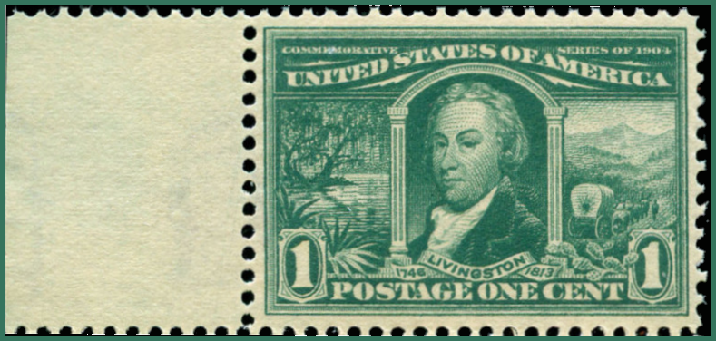
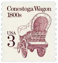
Robert R. Livingston
(* 1746, † 1813), US envoy in Paris 1803; swamplands (left), pioneers and Conestoga wagon in hilly countryside (right) |
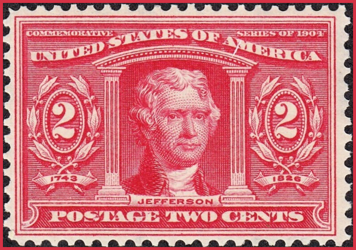
Thomas Jefferson
(* 1743, † 1826), third US President (1801-1809) |
|
|
|
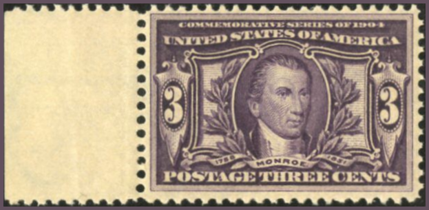
James Monroe
(* 1758, † 1831), US envoy in Paris 1803; fifth US President (1817 - 1825) |
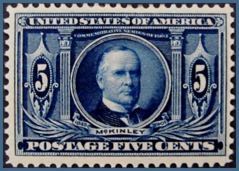
William McKinley
(* 1843, † 1901), 25th US President (1897-1901) |
|
|
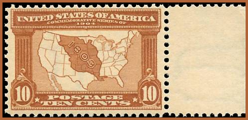
| Map of Louisiana Purchase | |
|
#323/327 // April 30, 1904
Commemorative Series of 1904 Louisiana Purchase Exposition St. Louis, MO, April 30 - December 1, 1904 The treaty of the Louisiana purchase was signed in Paris on April 30, 1803 |
|
|
Scott catalogue value for stamp set Nos. 323-327 (5)
US$ 950 (mint, never hinged), US$ 420 (mint, hinged), US$ 92 (used) |
|
|
|
|
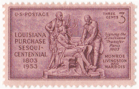
#1020 // April 30, 1953 // St. Louis, MO
Louisiana Purchase Sesquicentennial James Monroe (US diplomat, * 1758, † 1831), Robert R. Livingston (US diplomat, * 1746, † 1813), Francois Marquis de Barbé-Marbois (French politican, * 1745, † 1837), signing the Louisiana Transfer in Paris 1803 |
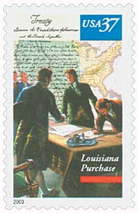
#3782 // April 30, 2003 // New Orleans, LA
Louisiana Purchase Bicentennial English Translation of Treaty, Map of the US and Treaty Signers |
|
|
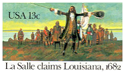
#UX95 // April 7, 1982 // New Orleans, LA
Stamped Postal Card 300th Anniversary La Salle claims Louisiana, 1682 Rene Robert Cavelier, Sieur de la Salle (French explorer, * 1643, † 1687), claimed all the land along the Mississippi River for France and founded the French Territory of Louisiana on April 9, 1682 |
|
|
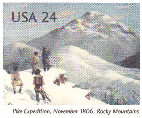
#UX449 // January 9, 2006 // Washington, DC
Stamped Postal Card Zebulon Pike Expedition at Pikes Peak, Rocky Mountains, 1806 Bicentennial |
| After the Louisiana Purchase in 1803, the US government ordered to explore the southern and western areas of the new territory and to map the terrain. On July 15, 1806 an expedition started from Fort Fort Bellefontaine near St. Louis, MO, led by US Army Lieutenant Zebulon Pike, Jr. (* 1779, † 1813), during which he recorded the discovery of what later was called Pikes Peak. The expedition was the first official American effort to survey the western Great Plains and the Rocky Mountains in present-day Colorado. |