US Postage Stamps
// Philatelic Project
// The Federal States


|
North Carolina // Raleigh, NC //
Southern Region //
Eastern Time
(The
Tar Heel State)
|
| First permant settlement: |
1653 by Virginia colonists |
| (Charter) Colony of Carolina created: |
March 24, 1663, extended in 1665 |
| North and
South
colony established:
|
1712, Royal colonies in 1729 |
Independence declared: |
April 12, 1776 |
| Union admittance: |
November 21, 1789 // 12th state |
Secession from Union: |
May 20, 1861 |
| Confederacy joined: |
May 21, 1861 (last state) |
| Civil War: |
April 12, 1861 - May 9, 1865 |
| Readmitted to Congress: |
June 25, 1868 |
| End of Reconstruction: |
November 28, 1870 |
|
[Display overwiew of states formed out of the original 13 colonies]
|
|
|
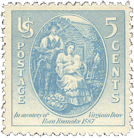
#796 // August 18, 1937 // Manteo, NC
350th Anniversary of the birth of
Virginia Dare on August 18, 1587,
first child of English parents born
in America on Roanoke Island,
the "Lost Colony",
present-day North Carolina
Virginia and her parents
Ananias and Eleanor Dare
|
|
|
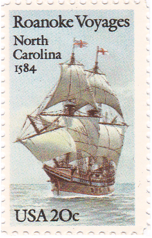
#2093 // July 13, 1984 // Manteo, NC
Roanoke Voyages
400th Anniversary of the first attempt
to settle on Roanoke Island, North Carolina
"The Elizabeth",
50 tuns sailing ship led by
Captain Thomas Cavendish
Vessel of the second Roanoke voyage,
sailed from England on April 9, 1585
(Roanoke voyages in 1584, 1585, 1587).
|
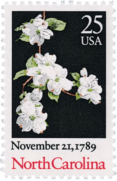
#2347 // August 22, 1989 // Fayetteville, NC
North Carolina Statehood,
Ratification of the Constitution
on November 21, 1789
Bicentennial
American Dogwood blossoms
(Cornus florida)
|
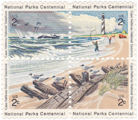
#1448-1451 // April 5, 1971 // Hatteras, NC
(se-tenant block of 4 different stamps
containing one overall design)
National Parks Centennial
Cape Hatteras National Seashore
Abandoned shipwreck in the Atlantic Ocean,
Cape Hatteras Lighthouse (first built in 1802),
black-headed gull sitting on driftwood,
sandy shore and marram grass
That area contains some of the earliest sites of
English colonial settlement. Located along North
Carolina's Outer Banks, the shores are home to
thousands of waterfowl and have become the
final stop for sections of ships that have
been wrecked on the shoals.
|
|

|
"Carolina" is taken from the Latin word for "Charles (Carolus)"
honoring King Charles II. of England (* 1630, r. 1660, † 1685),
who made the original land grant in 1663.
|

|
Land Area
rounded mi2 [km2]
48,711 [126.161]
ranked 29th
|
Population
(census 2010)
9,535,483
ranked 10th
|
Population Density
per mi2 [km2] of land area
197 [76]
ranked 16th
|
|
The State of North Carolina has 100 counties.
|
 The ZIP code turned 50 in 2013
Stamped Cards
|
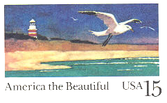
#UX132 // June 17, 1989 // Cape Hatteras, NC
Stamped Postal Card
America the Beautiful Series
Cape Hatteras Lighthouse,
shore and seagull
|
|
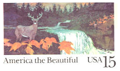
#UX133 // August 26, 1989 // Cherokee, NC
Stamped Postal Card
America the Beautiful Series
Forest, deer and waterfall
|
usaphil™


