
US Postage Stamps
// Philatelic Project
// The Federal States

|

|
||||||||||

|

|

|
|
#4315 // August 11, 2011
(self-adhesive coil definitive) Flags of Our Nation Series
Oklahoma State Flag
and oil-pumping equipment |
#1988 // April 14, 1982
(ex pane of 50 different stamps) State Bird & Flower of Oklahoma
Scissor-tailed Flycatcher
(Musicivora forficata) and Mistletoe |
#1678 // February 23, 1976
(ex pane of 50 different stamps) American Bicentennial Series Oklahoma State Flag |

|
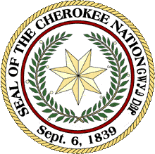
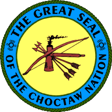
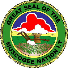
#972 // October 15, 1948 // Muskogee, OK
Indian Centennial Arrival of the Five Civilized Indian Tribes Cherokee, Chikasaw, Choctaw, Muscogee and Seminole in Indian Territory, later Oklahoma Map of Indian Territory and seals of the five tribes |
| [View map of forced displacment of Native American tribes by the US Government] | |
|
#1092 // June 14, 1957 // Oklahoma City, OK
50th Anniversary of Oklahoma Statehood Topographical outline of the state, Indian Arrow and Atom Diagram |

|

|

|
| #1360 // October 15, 1968 // Ponca, OK | #2754 // April 17, 1993 // Enid, OK |
|
75th and 100th Anniversary of the
opening of the Cherokee Strip to settlers on September 16, 1893 Racing for Homesteads |
|

|

|
|
#2722 // March 30, 1993 // Oklahoma City, OK
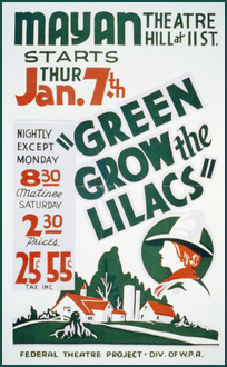
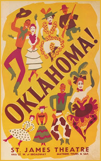
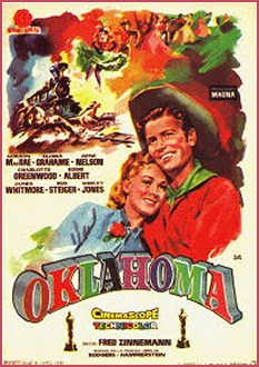
50th Anniversary of the premiere of the Musical "OKLAHOMA!" at St. James Theater on Broadway, NYC Principal performers Farm girl Laurey Williams and Cowboy Curly McLain The musical is based on Lynn Riggs' play (1930) "Green Grow the Lilacs" |
#4121 // January 11, 2007 // Oklahoma City, OK
Oklahoma Statehood Centennial Sunrise over the Cimarron River, (painting by Oklahoma artist Mike Larsen, born in 1944), "Oh, what a beautiful mornin' ...", lyrics from the musical "OKLAHOMA!" first performed in 1943 |

|
#3596 // April 4, 2002
(ex pane of 50 stamps, one for each state) Greetings from Oklahoma Illustration of contemporary postcard in the style of the 1930s/1940s View Oklahoma state quarter View Oklahoma state map View Oklahoma clock |

|
|
The origin of the state name are two words of the language of the
Choctaw Indian tribe, meaning "red people".
Oklahoma has the second largest Native American population after California.
|
||

|
Land Area
rounded mi2 [km2] 68,667 [177.847] ranked 19th |
Population
(census 2010) 3,751,351 ranked 28th (American Indians 406,492 - 8.6%) |
Population Density
per mi2 [km2] of land area 55 [21] ranked 37th |
| The State of Oklahoma has 77 counties. | |||

|
Historic Route 66 leads 432 miles (695 km) through Oklahoma. | ||

|
|
#UX130 // April 22, 1989 // Guthrie, OK
Stamped Postal Card Settling of Oklahoma First Land Run Centennial Racing for Homesteads |
| // Elmar R. Göller // All rights reserved // Contact // Publishing Information |
| modified |
