 US Postage Stamps
// Philatelic Project
// The Federal States
Location maps of the USA-Canada border states
From West to East:
Alaska,
Washington,
Idaho,
Montana,
North Dakota,
Minnesota,
Michigan,
Ohio,
Pennsylvania
(no border map available),
New York,
Vermont,
New Hampshire,
and
Maine

|
USA-Canada Border
Alaska (AK) // Yukon (YT) and British Columbia (BC)
|

|
USA-Russia maritime border along the International Date Line.
The boundary divides the Diomede Islands into
Ratmanow [eng: Big Diomede] Island,
Magadan County, East Siberia, Russian Federation
and Little Diomede [rus: Kruzenstern] Island,
Nome County, Alaska, United States of America.
The distance between the both islands is less than 2.5 miles (ca. 4 km).
|

|
|
Satellite photo of the Diomede Islands
|

|
View from the north of Bering Strait to the Diomede Islands
(Photo by Dave Cohoe on July 16, 2006)
Ratmanow [eng: Big Diomede] Island, Magadan County, East Siberia, RF
Little Diomede [rus: Kruzenstern] Island, Nome County, Alaska, USA
The distance between the both islands is less than 2.5 miles (ca. 4 km).
|

|
USA-Canada Border along the 49th parallel
Washington (WA) // British Columbia (BC)
|

|

|
USA-Canada Border along the 49th parallel
Idaho (ID) // British Columbia (BC)
|

|

|
USA-Canada Border along the 49th parallel
Montana (MT) // British Columbia (BC), Alberta (AB), and Saskatchewan (SK)
|

|

|
USA-Canada Border along the 49th parallel
North Dakota (ND) // Sasketchewan (SK) and Manitoba (MB)
|

|

|
USA-Canada Border along the 49th parallel
Minnesota (MN) // Manitoba (MB) and Ontario (ON)
|

|

|
USA-Canada Border
Michigan (MI) // Ontario (ON)
|

|
USA-Canada Border
Ohio (OH) // Ontario (ON)
|


|

|
USA-Canada Border along the 45th parallel
New York (NY) // Ontario (ON) and Quebec (QC)
|

|

|


|
USA-Canada Border along the 45th parallel
Vermont (VT) // Quebec (QC)
|

|


|

|
USA-Canada Border
New Hampshire (NH) // Quebec (QC)
|

|

|


|
USA-Canada Border
Maine (ME) // Quebec (QC) and New Brunswick (NB)
|

|
Map images by courtesy of
TBWG
("The Canada-United States Transportation Border Working Group")
 US Postage Stamps
// Philatelic Project
// The Federal States
Location maps of the USA-Mexico border states
From West to East:
California, Arizona, New Mexico, and Texas

|

|

|

|
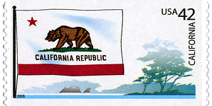
California State Flag
and coastal area
|
Arizona State Flag
and Saguaro cacti
|
New Mexico State Flag
and hot-air balloons
|
Texas State Flag
and field of cotton
|

|
| USA-Mexico Border |
California (CA) // Baja California (BC) // 140 miles [225 km]
California border counties: San Diego and Imperial
|
Arizona (AZ) // Sonora (SO) // 389 miles [626 km]
Arizona border counties: Yuma, Pima, Santa Cruz, and Cochise
|
New Mexico (NM) // Chihuahua (CH) // 180 miles [290 km]
New Mexico border counties: Hidalgo, Luna, and Doña Ana
|
Texas (TX) // Chihuahua (CH), Coahuila (CO), Nuevo Leon (NL), Tamaulipas (TM) // 1,241 miles [1.997 km]
Texas border counties: El Paso, Hudspeth, Presidio, Brewster, Terrell, Val Verde, Kinney, Maverick, Webb,
Zapata, Starr, Hidalgo, and Cameron
|
|
The light-grey and
dark-grey shaded area shows the USA-Mexico border region, 62.5 miles [100 km] north and south of the international boundary. It stretches approximately 2,000 miles from the southern tip of Texas
(Gulf of Mexico) to the Californian Pacific coast.
|
Please click
here
to learn more about the most frequently crossed international border in the world, with
ca. 350 million people legally
(and about half a million illegally from Mexico to USA) crossing per year.
|

usaphil™
 US Postage Stamps
// Philatelic Project
// The Federal States


