
US Postage Stamps
// Philatelic Project
// The Federal States

|
Oregon // Salem, OR //
Western Region //
Pacific/Mountain Time
(The Beaver State) |
|
| Territory established: | August 14, 1848 |
| Statehood granted: | February 14, 1859 // 33rd state |
| Oregon was formed out of land from British cession (1846). | |
|
[View map of US territorial acquisition]
[»This Day in History« - Learn more about OR's history] |
|

|

|

|
|
#4316 // August 11, 2011
(self-adhesive coil definitive) Flags of Our Nation Series
Oregon State Flag
camas lilies, Mount Hood |
#1989 // April 14, 1982
(ex pane of 50 different stamps) State Bird & Flower of Oregon
Western Meadowlark
(Sturnella neglecta) and Oregon Grape |
#1665 // February 23, 1976
(ex pane of 50 different stamps) American Bicentennial Series Oregon State Flag |

|

|
|
#783 // July 14, 1936 // Astoria, OR
Opening of the Oregon Territory Centennial Indian on Horse, Map of the Territory, Settlers and Covered Wagons |
#964 // August 14, 1948 // Oregon City
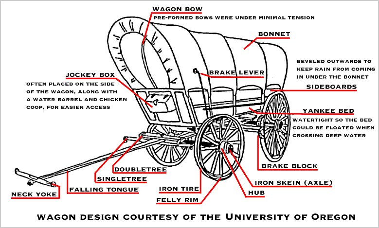
Establishment of Oregon Territory Centennial John McLoughlin (* 1784, † 1857) and Jason Lee (* 1803, † 1845) "Fathers" of Oregon, Ox-drawn Wagon on Oregon Trail |

|
#2747 // February 12, 1993 // Salem,OR
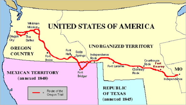
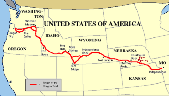
150th Anniversary of the Oregon Trail, a 2,000-mile [3.200 km] historic east-west, large-wheeled wagon route and emigrant trail that connected the Missouri River to the valleys in Oregon Map of the Trail |

|

|
|
#1124 // February 14, 1959 // Astoria, OR
Oregon Statehood Centennial Covered Wagon (Prairie Schooner), Stratovolcano Mount Hood (height 11,249 ft/3.429 m, last eruption in 1866) |
#4376 // January 14, 2009 // Portland, OR
Oregon Statehood Sesquicentennial Pacific Coastline of Oregon, painting by artist Gregory Manchess, a resident of Beaverton, OR |
|
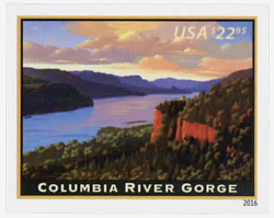
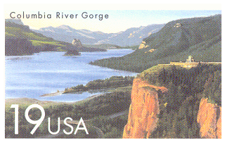
#5041 // January 17, 2016 // Washington, DC
Priority Mail ExpressTM Stamp The stamp is the 16th in a series of American Landmarks started in 2008 Columbia River Gorge
Showing a view facing east the stamp depicts the majestic gorge as sunset approaches with the historic »Vista House«, sitting atop »Crown Point« and overlooking the river 725 feet [221 m] below.
|

|
| Millions of years ago, the Columbia River cut through the Cascade Mountains and formed a deep gorge more than 80 miles [129 km] long and up to 4,000 feet [1.219 m] deep. Native Americans built large communities along its shores and it became a busy center for trade. The river's location made the area important for westward expansion. The »Lewis and Clark« expedition discovered in 1805 the Columbia River was the »Gateway to the Pacific«. Today, the gorge forms part of the border between the states of Oregon and Washington. | |

|
#3597 // April 4, 2002
(ex pane of 50 stamps, one for each state) Greetings from Oregon Illustration of contemporary postcard in the style of the 1930s/1940s View Oregon state quarter View Oregon state map View Oregon clock |
|
|
The origin of the state name, first used in 1776
by the colonial explorer Jonathan Carver (* 1710, † 1780) from Massachusetts, is uncertain.
"Oregon" might have been derived from a 1715 French map
which refers to the Wisconsin River as "Ouaricon-sint".
Another opinion is that the name "Oregon" stems from the English army
officer Major Robert Rogers' (* 1731, † 1795) proposal for a trip in 1765, in which he refers to "the River called by the Indians Ouragon". |
||

|
Land Area
rounded mi2 [km2] 95,997 [248.631] ranked 10th |
Population
(census 2010) 3,831,074 ranked 27th |
Population Density
per mi2 [km2] of land area 40 [15] ranked 40th |
| The State of Oregon has 36 counties. | |||

|
|
#UX119 // September 28, 1987 // Timberline, OR
Stamped Postal Card Historic Preservation Series 50th Anniversary of Timberline Lodge, Mount Hood National Historic Landmark Popular tourist attraction built between 1936/38 at an elevation of 5,960 feet (1.817 m) on the south side of Mount Hood, about 60 miles (97 km) east of Portland. |
| // Elmar R. Göller // All rights reserved // Contact // Publishing Information |
| modified |
