
US Postage Stamps
// Philatelic Project
// The Federal States


|
|
||||||||||||||

|

|

|
|
#4319 // August 11, 2011
(self-adhesive coil definitive) Flags of Our Nation Series
Rhode Island State Flag
and sailboat with a spinnaker |
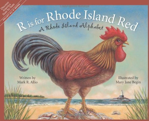
#1991 // April 14, 1982
(ex pane of 50 different stamps) State Bird & Flower of Rhode Island
Rhode Island Red
and Violet |
#1645 // February 23, 1976
(ex pane of 50 different stamps) American Bicentennial Series Rhode Island State Flag |

|

|
|
#777 // May 4, 1936 // Providence, RI
Founding of Rhode Island Colony Tercentenary Statue of Roger Williams (* 1603 , † 1683), former Puritan minister of Massachusetts, founder of the Rhode Island colony, fighter for religiuos freedom and separation of religion and state |
#2348 // May 29, 1990 // Pwatucket, RI
Rhode Island Statehood, Ratification of the Constitution on May 29, 1790 as last colony Bicentennial Slater Mill built in 1793, Pawtucket, RI |

|
#3599 // April 4, 2002
(ex pane of 50 stamps, one for each state) Greetings from Rhode Island Illustration of contemporary postcard in the style of the 1930s/1940s View Rhode Island state quarter View Rhode Island state map View Rhode Island clock |
|
|
The origin of the state name is uncertain and cannot be attributed to one source.
Italian explorer Giovanni da Verrazano (* 1485, † 1528) sailed into Narragansett Bay
in 1524. He shall have said that the land reminds him of the Greek Isle of Rhodes in the Mediterranean Sea or Dutch explorer Adrian Block (* 1567, † 1627) named the region "Roodt Eylandt", meaning "red island" in reference to the red clay that lined the shore.
However, it is fact that the state is the smallest one (by land area) of the union
but has the longest official name of any of the states. A ballot measure in 2010 asking the voters in Rhode Island to change the official state name "Rhode Island and Providence Plantations" to simply "Rhode Island" was defeated by a ratio of nearly 4 to 1. |
||

|
Land Area
rounded mi2 [km2] 1,045 [2.707] ranked 50th (smallest of all states) |
Population
(census 2010) 1,052,567 ranked 43rd |
Population Density
per mi2 [km2] of land area 1,018 [389] ranked 3rd |
| The State of Rhode Island an Providence Plantations has five counties. | |||

|
|
#UX112 // June 26, 1986 // Providence, RI
Stamped Postal Card 350th Anniversary of the Settling of Rhode Island Roger Williams (* 1603 , † 1683), Clergyman, Landing at Providence Ninth President (September, 1654 - May, 1657) under the Patent of 1643 of the Colony of Rhode Island and Providence Plantations |

|
|
#UX306 // July 24, 1999 // Block Island, RI
Stamped Postal Card Block Island Southeastern Lighthouse National Historic Landmark The lighthouse, built in 1875, is attached to a massive 2½ story brick Gothic double keeper's house, highest light (52 ft [16 m]) in New England located on Mohegan Bluffs, New Shoreham, RI Geographic coordinates: 41° 09' 10" N - 71° 33' 04" W [view photo] |
| // Elmar R. Göller // All rights reserved // Contact // Publishing Information |
| modified |

![[view photo]](../image/lh_blockisland_se.png)